
Geotechnical engineering demands tools that can capture complex subsurface conditions with high accuracy. And one of the most advanced solutions to this condition is Rocscience R3.
It has emerged as one of the most advanced solutions for the construction of true 3D geological models. Especially when precise boundary definition is critical for project safety. And this is the reason why most of the engineers now engage in the structured Rocscience training. It is to gain mastery over its modelling environment.
What is Rocscience R3
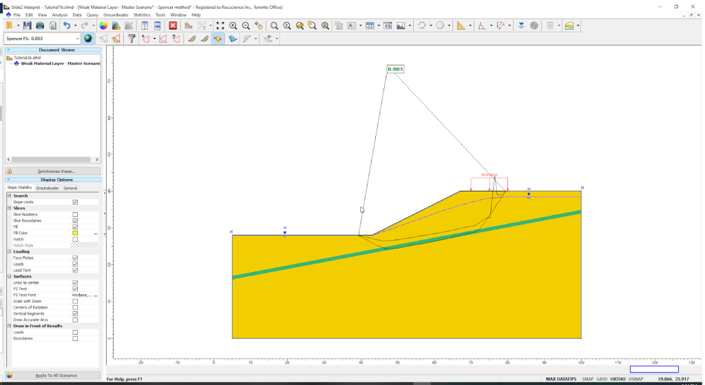
It is a 3D finite element analysis software. It is used mainly by the geotechnical, civil, and mining engineers to model complex structures.
It is designed to design and analyse various geotechnical structures. Like tunnels, slopes, and excavations. Also, it can do analysis for the groundwater seepage, consolidation, and the foundation design. The software provides you with the tools for rock and soil analysis.
Why Precise Boundary Definition Is Critical
An accurate interpretation of the geological boundaries directly affects the:
- Stress distribution modelling
- Excavation performance
- Designing the support system
- The predictive behaviour under the load condition
According to research published in multiple geotechnical journals, boundary misinterpretation contributes to 40% to 70% of design stage inaccuracy.
The numerical results may deviate significantly from the actual ground conditions if the interfaces between the soil, rock, and the discontinuities are not modelled correctly.
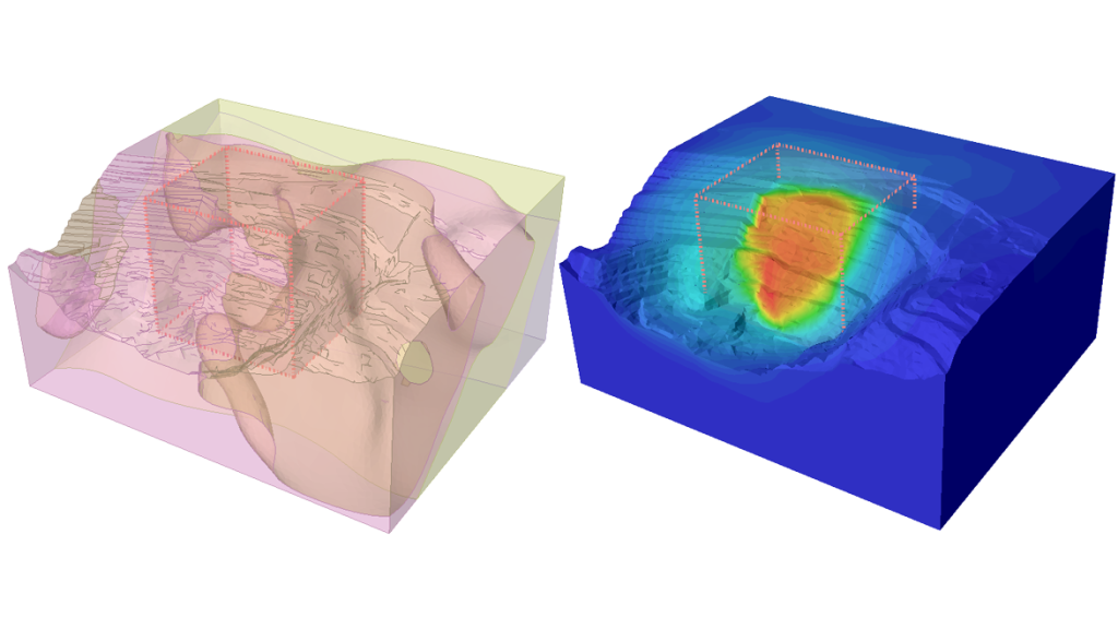
R3 solves this problem by enabling highly detailed, data-driven boundary construction.
How Rocscience R3 Handles Complex 3D Geological Modelling: Multiple Source Geological Data Integration
R3 allows seamless integration of real project data, such as:
- Borehole logs
- Geological cross sections
- Geophysical Interpretation
- Surface Topography
- Fault and joint network mapping
This helps to create a representative geological volume rather than a simplified conceptual model.
Implicit 3D Boundary Construction
R3 uses implicit surface generation algorithms to define boundaries with exceptional precision.
These algorithms have been shown to:
- Reduce the manual interpretation time by up to 55%
- Improve boundary smoothness and accuracy by 30%
- It automatically extends surfaces through complex folding or the faulting zones.
This is especially important in mining and tunnelling projects, where stratigraphy changes rapidly with depth.
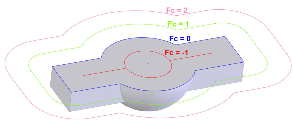
High Quality Meshing For Heterogeneous Geology
R3’s tetrahedral meshing engine supports:
- Sharp interface definition
- Multi-material interaction
- Local Refinements in complex zones
This helps to ensure numerical stability while maintaining geological authenticity.
What are the Skills Required for Engineers Using R3
A professional with a foundation in 2D and 3D numerical modelling workflows often gained through learning modules based on RS2 and RS3 concepts. It helps to adapt faster to R3’s environment.
But this is not enough. Advanced skills are also required to:
- Understand the volumetric geology
- Manage multi-material zones
- Define anisotropy across geological layers
- Model the complex contacts and discontinuities
This is the many reasons that many engineers follow the specialised modelling tutorials focused on the high-level Rocscience tools. It enables them to execute the large-scale simulations confidently.
Why R3 Expertise Is Becoming an Industry Requirement
The industry now prioritises high-resolution 3D geological interpretation. With the increased use of metro systems, hydropower tunnels, deep excavation basements and advanced mining operations.
R3 delivers:
- More reliable deformation predictions
- Better stability assessments
- Clearer communication with design teams and stakeholders
Engineers who build strong R3 modeling skills are better positioned to deliver safer and more accurate geotechnical designs.
For those aiming to upskill in high-resolution 3D modelling, PIGSO LEARNING provides structured training pathways tailored for R3 workflows.
Conclusion
Modern geotechnical projects demand accurate 3D geological modelling, and Rocscience R3 skills are becoming essential to meet this need. Precise boundary definition, realistic ground behaviour, and reliable predictions are only possible when engineers fully understand R3 workflows. With strong fundamentals from RS2 & RS3 training and focused Rocscience skill training tutorials, engineers can confidently handle complex geological conditions.
Structured Rocscience RS2 & RS3 Training, such as that offered by PIGSO LEARNING, helps professionals build these in-demand skills and deliver safer, more reliable geotechnical designs.
Contact us today to get started!